Saturday, November 01, 2008

Mount Whimper


View Larger Map

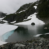
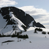
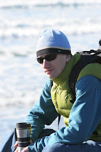
This Saturday I went to hiking trip to Mount Whimper - highest Canadian mountain south of 49th parallel - with Alpine Club of Canada (Vancouver Island section). Sandy Briggs was the trip leader. I attached route recorded with my GPS (blue section is the hiking route, and magenta is logging road leading to the trailhead - 4WD with high clearance is a must have for logging road). 
It was light rain, however we completed round trip (~9 km) in 4 hours. Elevation gain was ~850 m to the summit (1541 m).
I posted this route in Google Maps (My Maps section)
Let me know, if you need track logs for this trip.

Sunday, October 26, 2008

Saanich Peninsula Bike Tour


View Larger Map

There are two famous regional bike trails in Victoria - Lochside Trail, and Galloping Goose Trail. I did Lochside Trail couple of times before (I haven't done Galloping Goose trail yet). This time, I did Saanich Peninsula tour: I started Lochside trail up to Shwartz Bay ferry terminal, then turned to Lands End road up to the Moses Point, than Challet Road, Birch Road to West Saanich Road. From West Saanich Road I switch to Interurban Rail Trail (part of Centennial Trail System) before joining Galloping Goose. My bike speedometer measured 89 Km (uploaded GPS track is 86.5 km) - getting ready for Galloping Goose Round Trip...

This was a nice bike ride: fall colours, ocean views... With some small stops it took close to 4 hours and 30 minutes. Be careful at West Saanich Road - some parts are not bike-friendly - you have to share road with cars or pedestrians.

Saturday, October 25, 2008

Fall Colors at The Butchart Gardens

Fall Colors at The Butchart Gardens

Beautiful Fall colors at The Butchart Gardens were really impressive. Next big event will be Christmas Lights and Skating rink in December.

Monday, September 29, 2008

Whale at Botanical Beach

Whale at Botanical Beach
It was a lucky trip to Botanical Beach: Beautiful weather and ... Whale! My very first whale!
It was my fourth visit there (trip #1, trip #2, trip #3), but the only a first time a saw a gray whale there. Whale was feeding there, constantly diving and making fountains and splashes. Whale was kind enough to show almost full tail :). I am going to return in the middle of November when whales are coming back to California from Alaska.

Sunday, August 31, 2008

Road Trip: Vancouver Island, Inside Passage, Northern BC


View Larger Map

This is a map of our road trip that we did on August 16-24, 2008. Three hotels (Port Hardy before and Prince Rupert after ferry, and Whistler), five camping nights at Miracle Beach, Lakesle Lake, Tyhee Lake, Ten Mile Lake, and Lac La Hache Provincial Parks. On the mainland we had no single night without rain, but it was a wonderful trip to remember and to recommend. Truly, a BC Experience!

I wish we had two more days, to split driving from Telkwa to Ten Mile Lake and from Lac La Hache to Whistler.

If you have three-four-five-six :) more days and wish to get more Northern Exposure, it worth taking slightly different route after Terrace:


View Larger Map

I am going to do this loop next summer as part of my trip to Northern BC, Yukon and Alaska.

I am uploading five galleries from this trip in the following posts.

Tuesday, March 04, 2008

Friday, February 29, 2008

Port Renfrew - Lake Cowichan

Port Renfrew - Lake Cowichan


These pictures were taken along Port Renfrew - Lake Cowichan road. This road is use to be mostly gravel, however, it is almost all asphalt now (in February 2008 it had only 2 km of gravel in the middle of 54 km road).

I took this road as part of short road trip: Victoria - Port Renfrew - Lake Cowichan - Victoria (see map below). It is a good one-day road trip to show diversity of landscapes of Vancouver Island close to Victoria.


View Larger Map